Maps in New London County, Connecticut (CT) - Listings United States
 USA > Connecticut > New London County > Travel > Maps
Page 1 of 1
Historic USGS Maps of New England: Windsor Locks Quadrangle (Windsor Locks)
UNH DIMOND LIBRARY Documents Department Data Center Historic USGS Maps of New England New York Windsor Locks, CT Quadrangle USGS 7.5 Minute Series Latitude 41.9375 Longitude 287.3125 1946 ...
http://docs.unh.edu/nhtopos/WindsorLocks7.5CT.htm
New London County Map - 1895 (New London County)
NEW LONDON COUNTY CONNECTICUT 1895 1895 U.S. Atlas Connecticut 1895 U.S. Atlas Main Title Page Livingston County MI Historical Genealogical Project USGenNet.org - The 1st ONLY 501c3 host for ...
http://www.livgenmi.com/1895/CT/County/newlondon.htm
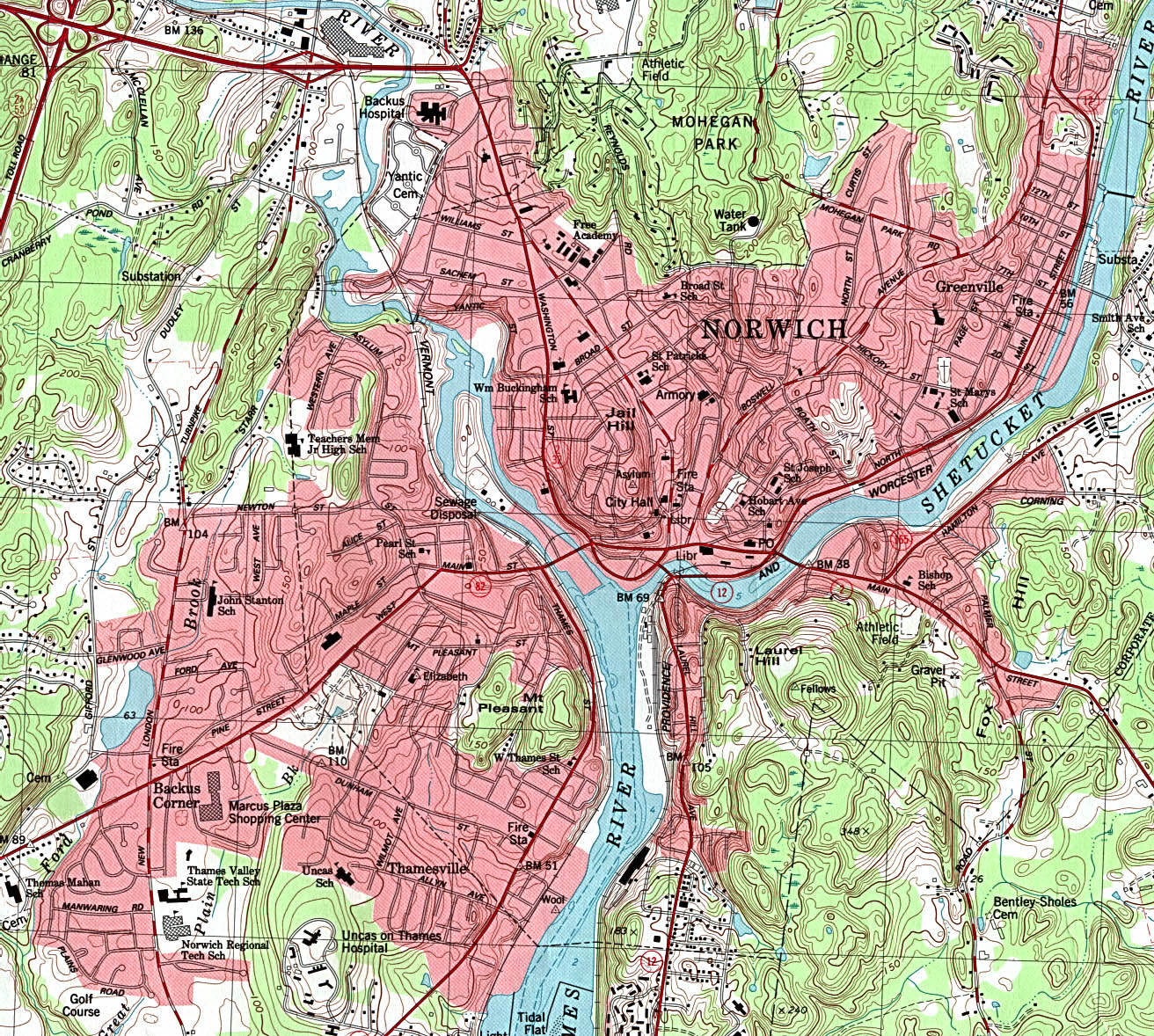
Topographical Map of Norwich (Norwich)
http://www.lib.utexas.edu/maps/united_states/norwich_conn_83.jpg
View of Windsor Locks in 1877 (Windsor Locks)
To change view, select desired zoom level and window size from the options below the Zoom View window and then click on the image. The display will be centered where you click. To move up, down, ...
http://lcweb2.loc.gov/cgi-bin/map_item.pl?data=/gmd378/g3784/g3784w/pm001031.sid&style=gmd&itemLink=D?gmd/temp/~ammem_Cm5G::&title=View+of+Windsor+Locks,+Conn.,+1877+/+/
Page 1 of 1
LastModified: Jan-01-13 V4
Home |
Add/Modify Listing |
Photo Gallery |
Maps |
Contact |
About Us |
Canada
Privacy Statement
This site is operated by 2026
Cedar Lake Software
